
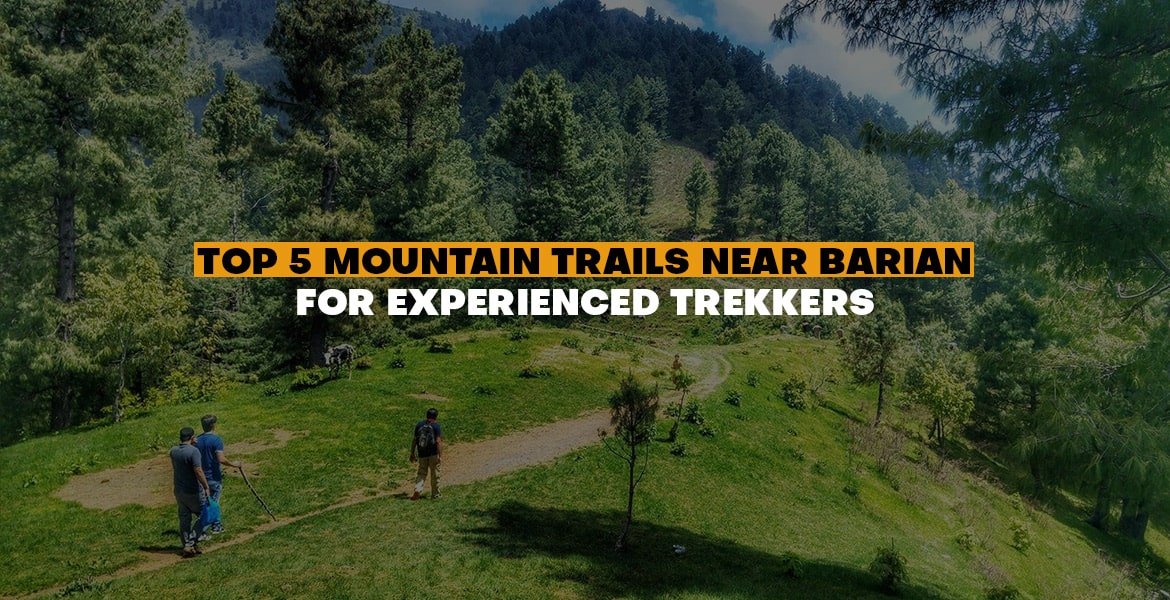
Murree, a popular hiking and trekking destination in Pakistan is an area with hill stations and the scenic village of Barian. Barian refers to a hill station in Pakistan with the most difficult yet rewarding mountain trails. Trekkers usually seek the less developed, rough trails around Barian that can be adventurous and at the same time offer a panoramic view. For the seasoned hiker, Barian offers tracks that range from climbing steep forests to long meadows and distant Murree hiking trails.
Why is Barian a Good Trekking Base?
Barian is located about 12 km from Nathia Gali. It is accessible not only through Murree but also through Abbottabad and is surrounded by thick pine forests, rolling hills and unspoiled valleys. With a much less commercial atmosphere than the bustling Mall Road at Murree, Murree Barian remains a haven to those who desire a genuine trekking experience. The major benefits of Murree hiking tracks are:
- These are close to the iconic hills of Galyat such as Miranjani and Mushkpuri.
- Access to lesser-known trails such as Thandiani to Barian.
- A ratio of difficult landscapes and relaxing resting spots.
- Fresher weather all through the year.
Top 5 Mountain Trails Near Barian
Keeping that in mind, we are going to reveal the five best trails every seasoned trekker should look into around Barian.
1. Miranjani Peak Trek – The Crown Jewel
When asked about their favorite hike in the area near Murree or Barian, Miranjani Peak will frequently be at the top of the list of seasoned hikers.
Trail Overview
| Feature | Details |
| Location | Nathia Gali (~35 km from Barian) |
| Elevation | 2,992 m (highest in Galyat) |
| Distance | ~8 km round trip |
| Duration | 4–5 hours (ascent + descent) |
| Difficulty | High – steep climbs, endurance needed |
| Highlights | Dense pine forests, views of Nanga Parbat and Kashmir |
What Makes It Special?
The Miranjani trek is a challenge. The trail starts at the Governor’s House of Nathia Gali and passes through thick forests of pine, oak and walnut subtropical forests. The path is quite uphill at some points, and it takes powerful muscles and energy. On a clear day, trekkers are blessed with panoramic views of both the snow-crowned Nanga Parbat, in the distance, and panoramic views of Abbottabad, Mansehra and even Kashmir.
Why It’s for Experienced Trekkers?
- Sharp uphills and hard-to-find switchbacks.
- Significant elevation gain within a short distance.
- High altitude weather can change rapidly, which puts preparedness to the test.
Start early in the morning when the skies are clear, and bring enough water, as the trail is low on supplies.
2. Mushkpuri Top Trek – A Scenic Escape
Mushkpuri Top is often regarded as the second-highest point of this region. It is breathtaking and rewarding.
Trail Overview
| Feature | Details |
| Location | Access from Dunga Gali or Ayubia |
| Elevation | 2,800 m |
| Distance | ~4 km (from Dunga Gali side) |
| Duration | 2–3 hours |
| Difficulty | Moderate–High (steeper via Dunga Gali) |
| Highlights | Wildflowers, meadows, and Kashmir valley views |
What Makes It Special?
It is characterized by a high pine tree, wild flowers, and expansive grasslands.On reaching the peak you see the entire surrounding mountains. The Foothill Way is middle-aged though the Dunga Gali trail is stiffer and more rigorous and it is more suitable for strong trekkers.
Why It’s for Experienced Trekkers
- Difficult climbing in the Dunga Gali path.
- Steep and narrow forest paths that test balance.
- Requires good stamina for a quick ascent.
The summit meadow is perfect for short camping stays—if you’re an experienced trekker with overnight gear, Mushkpuri offers an unforgettable starlit sky.
3. Dunga Gali – Ayubia (Pipeline Track)
The Pipeline Track may appear to be a safer alternative at first glance; however, it can be used with more challenging routes and makes for a satisfying long hike for an experienced trekker.
Trail Overview
| Feature | Details |
| Location | Connects Dunga Gali with Ayubia |
| Elevation | ~2,500 m (gently undulating) |
| Distance | 4–5 km (one way) |
| Duration | 1.5–2 hours |
| Difficulty | Moderate–Low |
| Highlights | Scenic forest walk, ideal for combining with other treks |
What Makes It Special?
This path was initially constructed to protect a water pipeline. This is nearly level and passes by a dense forest, so the walk is not very hard. It is neither so steep nor long as the Miranjani or Mushkpuri paths, but it boasts of numerous scenic views, bird-watching opportunities and fresh mountain air.
Why It’s for Experienced Trekkers
- It may be a warm-up hike to take before trying Miranjani or Mushkpuri.
- It turns into a long walk when it is prolonged with loops or return hikes.
- Appropriate to train pace and stamina control.
Advanced trekkers typically undertake a two-day challenge that combines the Pipeline Track and Mushkpuri.
4. Thandiani to Barian Trek – A Remote Adventure
The Thandiani-Barian trail is a hidden gem among trekkers seeking to explore less-traveled routes.
Trail Overview
| Feature | Details |
| Location | Between Thandiani and Barian |
| Elevation | Varies (moderate gain/loss) |
| Distance | ~10 km (one way) |
| Duration | 4–6 hours |
| Difficulty | Moderate (requires endurance & planning) |
| Highlights | Solitude, remote meadows, thick forests |
What Makes It Special?
Business trips pass through wide grasslands, rainforests and villages, providing individuals with privacy and authentic interaction with the people. This is an all-natural adventure that is best suited for hikers who appreciate quietness and the natural environment.
Why It’s for Experienced Trekkers
- A remote area needs good navigation skills.
- Facilities are limited; hikers must carry their own.
- You must have good endurance to make a long walk.
Always inform somebody where you are going, since cell phones do not exist everywhere. First-time hikers should use a local guide.
5. Changla Gali Trails – Off-the-Beaten Path
Changla Gali, approximately 40 km from Barian, is a small hill station renowned for its colonial charm and lush forested beauty.
Trail Overview
| Feature | Details |
| Location | Changla Gali (~40 km from Barian) |
| Elevation | 2,500–2,700 m |
| Distance | 5–8 km (varies by route) |
| Duration | 2–5 hours |
| Difficulty | Moderate |
| Highlights | Pine forests, historic charm, less-trodden paths |
What Makes It Special?
Such mountain trails are suitable in cases when experienced hikers are interested in discovering a route themselves and hiking away the track. They pass through pine forests, secret meadows and ancient colonial grounds, which makes them a special option.
Why It’s for Experienced Trekkers
- In other cases, the trails are not marked and thus you require good navigation and orienteering skills.
- It is possible to spend a few days camping in the area.
- The rugged, unused terrain increases the difficulty.
Comparison Table – Top 5 Trails
| Trail | Distance / Duration | Difficulty Level | Best For |
| Miranjani Peak | 8 km / 4–5 hrs | High | Stamina & summit seekers |
| Mushkpuri Top | 4 km / 2–3 hrs | Moderate–High | Scenic trekkers, steep forest climbs |
| Pipeline Track | 4–5 km / 2 hrs | Moderate–Low | Warm-up or combined endurance hikes |
| Thandiani–Barian | 10 km / 4–6 hrs | Moderate | Solitude & remote trekking |
| Changla Gali Trails | 5–8 km / 2–5 hrs | Moderate | Explorers & off-beat adventurers |